Introduction
With the increase in digital technology, organisations are using much bigger data sets to understand patterns. Businesses, banks, transport companies, research bodies and government bodies are all using vast amounts of data to gain insight. A lot of this data will contain geographical information, distances, shapes, and multi-dimensionality.
This can cause problems if we do not use the right techniques to process data. Computational geometry uses maths and advanced computing techniques to understand the complex data. This section will show you how computational geometry can be used to help with large data sets.
Big Data and Computational Geometry
Big data is very large and complex data sets that are difficult to process using traditional techniques. Big data usually has 4 key traits (volume, velocity, variety and complexity). This can include geographical data, satellite images, road networks, bank details, customer locations, 3D models and data from millions of connected devices. To process this data we need systems in place to help us organise data, see patterns and do calculations. Computational geometry helps us do this by providing mathematical solutions to help with data sets and problems relating to points, lines, polygons, distances, intersections and layouts. Computational geometry can help large data sets by using geometric algorithms to help understand data.
This is very important when dealing with data that has spatial elements. For example, a transport company may wish to find the shortest route between multiple delivery locations. They will need to know how the roads lay out, what the traffic is like and any geographical issues. An environmental research body may want to analyse satellite images to see how the coverage of forests has changed. Computational geometry helps with this by providing algorithms to find distances, detect intersections, find nearby objects and organise data. Using big data means we can do this with a huge amount of geometric data without having to look at each element.
Key Computational Geometry Techniques in Big Data
1. Spatial Indexing
Spatial indexing is a very important technique used to help organise data. This helps organise spatial objects so that the computer can find what they need without looking through all the data. Traditional databases use indexes to help find data, but this is usually for simple data such as names, dates and ID numbers. Spatial data has additional information such as coordinates, borders, shapes and geographical elements. Spatial indexes help with this by grouping nearby objects or organising them by their shape. Common indexes include R-trees, quadtrees, K-D trees and Grid. This helps databases find relevant objects quickly.
Big data can have millions or billions of pieces of geographical data. For example, a mapping system may need to find all the restaurants, hospitals, roads and houses in a particular area. Without the correct index this could take the system a long time to find the answers. Spatial indexes help narrow down the search area. This helps with query performance by organising objects by their location and shape. These indexes can be used in geographic information systems, location based applications, environmental monitoring and urban planning. Using distributed databases and cloud computing helps keep the data organised and available quickly.
2. Geometric Search
Geometric searching helps find objects that meet certain spatial criteria. Unlike traditional searching in databases, geometric searching looks at the relationships between points, lines, polygons and other spatial objects. This could be finding objects within a certain geographical area, roads that cross a specific area or buildings within a certain distance of a river. This is important as many decisions in real life situations depend on knowing where objects are. Computational geometry provides algorithms to detect intersections, find points, range search and proximity. This helps organisations find the relevant spatial data.
Large organisations will often use geometric searching to find objects in large data sets. This could be an insurance company finding properties in certain areas that are prone to flooding or other environmental issues. Logistics companies may want to find delivery addresses in a specific area. Telecommunications companies may want to find areas within their network coverage. This requires accurate geometric calculations and quick database searches. Spatial searching can also help emergency services find hospitals, escape routes and communities within a certain area. Using geometric searching along with spatial indexing and distributed computing helps these organisations find useful information quickly.
3. Spatial Clustering
Spatial clustering helps group objects together based on their location, similarity or relationship. This helps organisations find areas where specific activities or features occur frequently. Unlike simple data classification, this looks at the geographical data and how far apart the objects are. Common clustering algorithms include DBSCAN and spatial versions of K Means. This helps find clusters of nearby points. For example a retail organisation may want to find areas with high demand for specific products based on customer locations. A public health research team may want to find areas with a high occurrence of illness based on the geographical spread. This helps turn large amounts of individual spatial data into meaningful information.
When processing spatial clusters in big data we need algorithms that can handle large amounts of data without causing too much computation. Distributed clustering helps break the data down into smaller pieces so that multiple computers can process the data. This can be helpful when analysing data from mobile applications, connected devices, satellite images and transport. Spatial clustering can also help with urban development by finding high population areas, busy areas of commerce and areas of rapid growth. Financial institutions may also want to group their customers geographically to understand their distribution and detect any unusual patterns. Spatial clustering helps uncover patterns that may not be obvious in large data sets.
4. Nearest Neighbour Algorithms
Nearest neighbour algorithms are part of computational geometry that can be used to find the closest objects to a specific point. This is important in situations where knowing the distance between objects is important. This can be seen in navigation applications to find the closest petrol station, hospital, restaurant or other service. Delivery companies may also want to find the closest distribution centre. When there are millions of geographical objects in a data set, the distance between each object can be computationally intensive. Computational geometry helps with this by providing optimised algorithms such as spatial trees and searching algorithms to help reduce unnecessary calculations.
Nearest neighbour algorithms are also useful in big data applications. They can help find similarities between multi-dimensional objects. Researchers may look at multiple measurements of geographical observations such as height, temperature, vegetation and soil type. Financial institutions may look at the location of transactions along with other relevant information to detect any unusual geographical patterns. Transport companies can also use this to improve their deliveries. The quality of data, distance and spatial index will affect how well this works. Using nearest neighbour algorithms along with scalable databases and distributed computing can help organisations do complex proximity searches on large data sets.
Spatial Databases
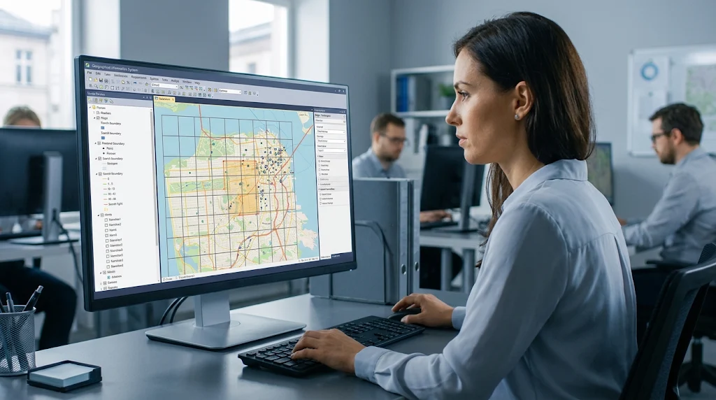
Spatial databases are a specialist form of database that can store, organise, search and analyse geographical data. Unlike traditional databases which store text, numbers and other values, spatial databases can store points, lines, polygons and other multi-dimensional data. They also have functions to help calculate distances, find intersections, calculate areas and look at spatial relationships. This makes them useful for organisations that use geographical data in their day to day operations. Some common spatial databases include PostgreSQL with PostGIS, Oracle Spatial and Microsoft SQL Server spatial. This allows users to store traditional business data along with geographical data.
When dealing with large spatial data sets, the database needs to handle increased data, frequent updates, multiple queries and complex analytics. For example, a mapping company may want to store detailed road networks, building boundaries, landmarks and traffic. When users ask for routes or nearby locations, the database needs to find the relevant data quickly. Spatial databases use indexes, optimised searching, geometry and other technologies to help with this. Many organisations also use spatial databases along with data warehouses and cloud storage to help analyse large data sets. This helps link geographical data with financial, commercial, environmental and operational data.
Distributed Computing
Distributed computing splits tasks between multiple computers. This can be useful for big data as there may be a huge amount of spatial data. This means the data can be split into chunks and processed on multiple computers. Technologies such as Apache Spark and Hadoop can help with large data sets by splitting the workload between multiple computers. This can be combined with computational geometry to do things such as spatial joins, clustering, distance calculations and geographical aggregations. This means large data sets can be analysed.
There can be issues with distributed spatial data. If objects are near the edge of the data set they may need to be looked at together even though they are on separate computers. For example, if all the objects within a certain distance of the boundary need to be found, the data from neighbouring chunks may need to be used. If this is not handled correctly, relevant objects may be missed or unnecessary calculations may be done. Data needs to be split, managed, communicated between computers and balanced. Spatial partitioning can be used to group relevant geographical data together. Using the correct indexes and distributing the workload means large geographical data can be processed efficiently.

Real World Applications of Computational Geometry in Big Data
1. Geographic Information Systems and Environmental Research
Geographic Information Systems (GIS) are one of the most important applications of computational geometry in big data. This allows organisations to gather, store, visualise and analyse geographical data. Environmental researchers can use GIS platforms to look at satellite images, track deforestation, see changes in land use and look at the distribution of natural resources. This often involves very large data sets containing geographical data, pixel data, height and environmental data. Computational geometry helps researchers find geographical boundaries, calculate distances, find overlaps and look at spatial patterns. Spatial indexing and distributed computing can help analyse data from multiple satellite images and geographical surveys.
Environmental organisations can also use geometric data. Researchers may look at rainfall, height, river boundaries and population to find communities at risk of flooding. Conservationists can look at the distribution of forests, wildlife and protected areas. Agricultural researchers can look at soil type, rainfall and field boundaries. This helps turn geographical data into useful information. Researchers and governments can use computational geometry to analyse complex spatial data sets to find environmental patterns, evaluate potential risks and create strategies to help manage resources.
2. Transport, Logistics and Urban Planning
Transport companies heavily rely on spatial data. Large transport systems will produce a constant stream of geographical data from GPS, mobile applications, traffic sensors and vehicle monitoring. Computational geometry can help analyse this data. This can help find nearby locations, calculate distance and look at the relationships between roads and geographical data. Route planning applications use geometric and graph based algorithms to help evaluate different routes. This can be combined with live traffic data to help find alternative routes. Logistics companies can also use spatial clustering to group delivery locations and nearest neighbour algorithms to help assign nearby locations.
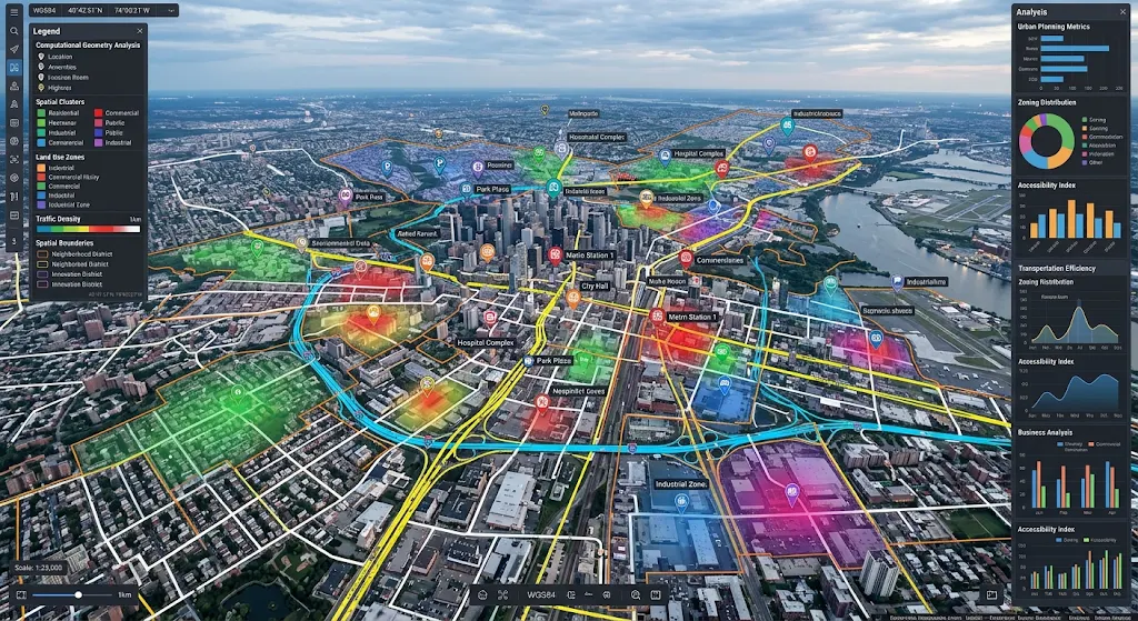
Urban planners can use these techniques to understand how cities develop. They may look at population distribution, road networks, public transport, building locations and service locations to find areas of rapid growth or poor accessibility. Spatial queries can be used to see if residential communities are within a reasonable distance of schools, hospitals and public transport. Geometric calculations can be used to look at land boundaries. This can help evaluate potential conflicts between new developments and current infrastructure. Large data sets can be analysed to see the whole metropolitan area. This helps urban planners make better decisions regarding infrastructure, transport and make cities more accessible.
3. Financial Institutions
Financial institutions are increasingly using geographical data to understand customers, evaluate business opportunities and improve certain aspects of risk management. Banks, insurance companies and payment service providers may process data such as transaction locations, customer addresses, property information and regional economic indicators. Computational geometry can help organisations find geographical patterns, calculate distances and look at relationships between locations. For example, a bank may look at customer distribution to find suitable locations to open new branches or automated banking. Insurance companies can look at property boundaries and geographical hazards to evaluate potential risks in different areas. This needs to be processed efficiently as financial institutions may have large databases with information from thousands or millions of customers/transactions.
Geographical data can also be used to help monitor financial data. Financial institutions may look at transaction locations, times and other indicators to find any unusual activity. Spatial searching can be used to find relationships between transaction locations. Clustering can help find any unusual groupings in certain areas. This shouldn’t be used alone to indicate fraud, but financial institutions should take other information into consideration. They also need to ensure data is accurate, private and that the data has been looked at by humans. Computational geometry can help analysts organise and analyse spatial data efficiently.
4. Retail
Retail businesses produce large amounts of data. This can be from online sales, physical stores, loyalty schemes and location based services. Spatial data can help organisations understand where customers are, how they interact with different stores and where there are business opportunities in certain areas. Computational geometry can help find clusters of customers, calculate distance between stores and look at relationships between commercial locations and residential areas. For example, a supermarket chain may look at population density, customer distribution, transport links and competition to choose a new location. Spatial indexing can help these businesses find relevant geographical data quickly even if they have data from multiple cities or countries.
Retailers can also use spatial data along with sales data and demographics. Clustering may help find areas where certain products are popular. Nearest neighbour searching can help evaluate how easily customers can reach existing stores. This can help with decisions regarding store placement, stock distribution, deliveries and marketing in certain areas. E-commerce businesses can also use geographical data to help choose the best warehouses. Combining computational geometry with big data analytics can help retailers move away from general sales data and look at how geographical factors affect their business. This gives more detailed information about customer distribution.
New Technologies Improving Big Data and Computational Geometry
1. GPU Acceleration
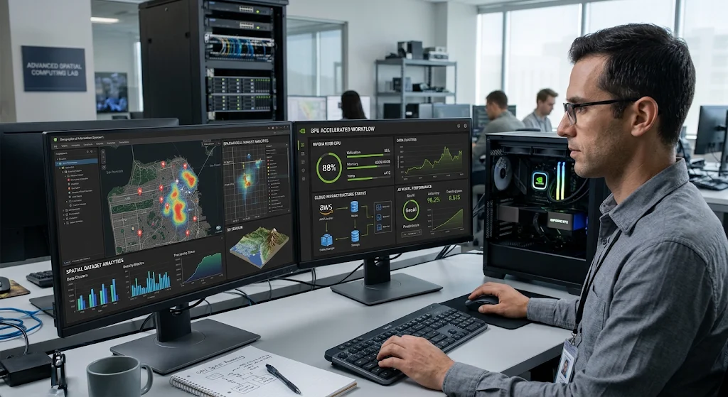
Graphics Processing Units (GPUs) are becoming increasingly used when processing lots of large data. Whilst GPUs were designed to process graphics they can be used for scientific computing, artificial intelligence, and to help with geometric data due to their ability to process lots of calculations at the same time. Many processes in computational geometry require many calculations to be done on a set of points, distances, intersections and relationships. As there could be millions of objects in a dataset, it becomes inefficient to do this on a regular processor. By using GPU acceleration we can offload any suitable processes to many cores, this can save time and therefore improve the performance of any computationally heavy applications.
This can help organisations with big data by allowing them to work on spatial data such as satellite images, 3D modelling, spatial simulations and large clustering. For example, if a researcher is looking at high resolution geographical images they can use systems with GPU acceleration to transform the image and find any geometrical features quickly. Transport organisations may also benefit from faster calculations when analysing their large road networks and location data. Not all geometric algorithms will benefit from using a GPU however, some processes can be complex and cause frequent data movements which can reduce the effectiveness of GPU acceleration. Organisations will need to ensure they are using the right algorithms and optimising their systems to get the best out of their hardware. If used correctly, GPU acceleration can give organisations extra processing power.
2. Cloud Computing
Cloud computing has changed how organisations store and process large datasets. Instead of organisations having to invest in lots of servers they can use cloud platforms to help with storing data, databases, processing and special analytics tools. This can be particularly helpful to organisations who work with geographical data that is constantly increasing. Organisations can easily scale their processing power in the cloud to handle large satellite images, geographical surveys, transport data, etc. They can also easily spread the processing between many machines in the cloud to help manage their demanding analytics.
A scalable spatial infrastructure includes a cloud storage, spatial database, distributed processing and indexing. A mapping organisation may use cloud storage to store lots of their geographical data. They can use spatial databases to handle queries and distributed processing to handle large analytical processes. This enables them to have many users and applications using the data. The cloud can help organisations collaborate by enabling researchers and organisations from different locations to access the data and analytics. However, businesses will need to consider how secure their data will be, data privacy, network performance, cost of the services and regulations. Careful planning of their infrastructure will ensure that the system is still reliable.
3. Artificial Intelligence and Machine Learning
More and more organisations are combining computational geometry with artificial intelligence and machine learning. Machine learning uses algorithms to find patterns, classify and predict using historical data. Computational geometry can be used to perform spatial processes to help organise the data. For example, a machine learning model could be used on satellite images to identify buildings, roads, vegetation and land use changes. Using geometric algorithms can help determine the boundaries, area and spatial relationships of objects. This can help organisations gain more meaningful insights from their large datasets.
Computational geometry and artificial intelligence can be used in many applications such as transport, environmental research, agriculture and urban planning. A transport organisation can use machine learning predictions alongside spatial analysis to understand how traffic patterns change and look at alternative routes. Researchers in agriculture can use geographical measurements and environmental readings to identify differences in crops across large areas of land. Urban planners can use predictive models along with geometric data to look at potential patterns of population growth. However, organisations will need to consider how good their data is, limitations of the algorithms, cost of processing and risk of inaccurate predictions. Human knowledge will still be required to understand the outputs.
Challenges of Complex Spatial Data
There can be many challenges when using computational geometry for big data. Firstly, handling lots of data can become difficult. Large high resolution satellite images, detailed road networks, 3D models and continuous location data can require large amounts of storage. Secondly, when gathering geographical data from many devices, surveys and programmes there can be issues with the data quality. This can include missing coordinates, incorrect measurements, non-uniform data and old data. This can cause issues with geometric calculations and produce misleading results. Organisations will need to ensure that they have data validation, cleansing and standardisation processes in place.
Some geometric processes can become more expensive as there are more objects. This can cause issues with complex intersections, spatial joins and calculating distances. Using distributed systems can help with this issue but can cause complications with communication between computers, distributing workloads, partitioning data and synchronisation. Also, there can be sensitive data within geographical data so organisations will need to ensure they have the correct security measures in place. This can include access control, encryption, data privacy and data governance. Organisations will need to consider the cost of specialised infrastructure such as GPUs, cloud storage and distributed systems. Efficient algorithms, reliable data handling, appropriate hardware and careful system design will be required.
Future of Big Data and Computational Geometry
Computational geometry will play a big role in the future of big data due to increased demand for real time spatial analysis, increased processing power and complex geographical applications. As organisations have more connected devices, autonomous systems, satellites and digital maps they will need more efficient ways to process large amounts of spatial data. Improvements in GPU acceleration, distributed databases, cloud and parallel algorithms will help to improve the speed and scalability of geometric processes. This will help with applications that require continuous analysis of geographical data such as transport, environmental monitoring, infrastructure planning and large scale scientific research.
Computational geometry will also be combined more with spatial computing, artificial intelligence and advanced multi dimensional data analysis. Organisations are becoming more interested in understanding data that is not limited to 2D. 3D models, digital twins, complex simulations and location aware systems require ways to understand data across multiple dimensions. Computational geometry will provide the necessary mathematical foundation to help with representing objects, spatial relationships, finding intersections and optimising data. As these technologies improve organisations will be able to turn huge amounts of complex data into usable information. The best systems will likely use efficient geometric algorithms, scalable infrastructure, reliable data handling and human knowledge to provide accurate results.
Conclusion
Big data and computational geometry have become very linked. As organisations have more geographical data coming from satellites, sensors, mobiles, financial systems and connected infrastructure they can no longer use traditional methods to process their data. Spatial indexing, geometric searching, clustering, nearest neighbour and spatial databases can help organisations to efficiently organise and understand their data. With distributed processing, GPU acceleration and cloud systems this can be improved further.
These technologies can be used across many industries to help with real life applications such as transport planning, environmental research, financial analysis, expansion in retail and managing geographical information. They can help organisations find patterns, understand spatial relationships, improve efficiency and make more informed decisions. However organisations will need to ensure they have accurate data, efficient processing, cost effective infrastructure, data privacy and security. As AI, cloud and multi dimensional data improves computational geometry will still play a big role in modern big data infrastructure. Organisations will be in a better position to understand complex data if they use efficient and scalable methods to process their spatial data.