Introduction
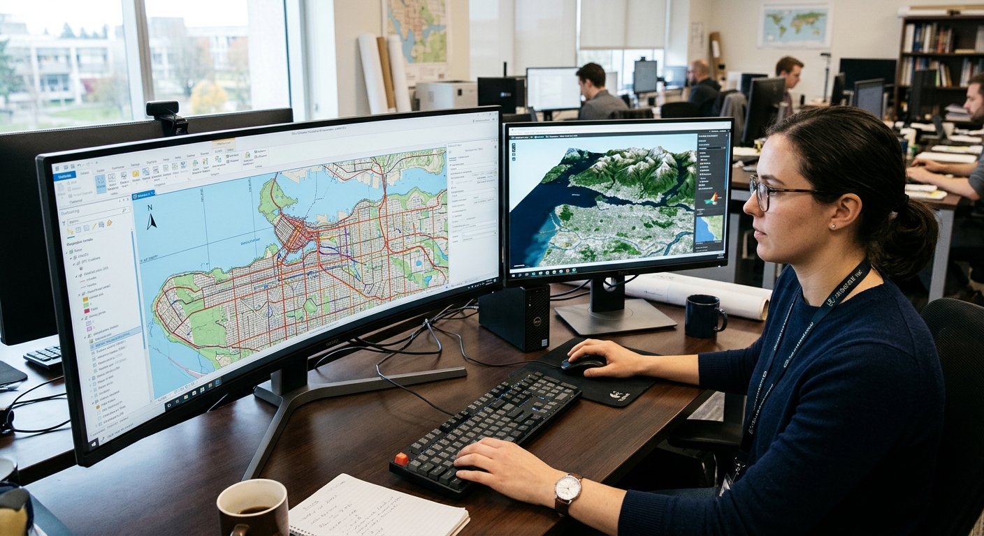
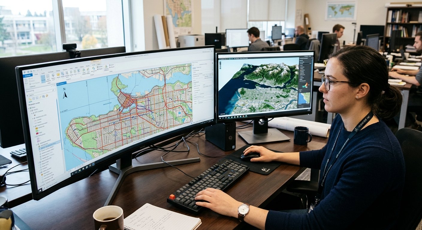
Geographic Information Systems (GIS) and digital mapping have become an essential tool for understanding locations, analysing geographical data and making informed decisions. Whether it is city planning, transport management, environmental changes or tracking natural resources, individuals, companies and governments can gain valuable knowledge from these systems. However, to fully understand geographical data using computers there are mathematical calculations which need to be performed.
Computational geometry plays an important role in this by allowing computers to use mathematical algorithms to perform calculations on geometric objects. Computational Geometry in GIS provides a mathematical basis for some very useful operations in modern mapping platforms, increasing their intelligence. This has helped to improve the way we collect, analyse, visualise and implement geographical information.
Computational Geometry in Geographic Information Systems
Computational geometry is a branch of computer science and mathematics which focuses on creating algorithms that solve problems related to geometric objects. These can include points, lines, curves, polygons, surfaces and 3D objects. In the context of geography, these objects will often be used to represent real life features such as buildings, roads, rivers, lakes, land boundaries, mountains and administrative areas. Computational geometry provides a way for computers to analyse these features. It can calculate relationships between these objects. For example, using geometric algorithms a GIS application can determine if a road crosses a river, if land boundaries overlap and how far away a building is from the nearest public facilities.
Geographic Information Systems use geographical data to collect, store, manage and analyse information related to locations. Computational geometry can help improve some of the operations provided by these systems. A typical GIS dataset will contain millions of geographical objects. Each of these will contain some sort of coordinates, size, boundaries and relationships. To analyse each of these would take a long time to process, however using geometric algorithms can help simplify this. This results in computational geometry being used to help with important GIS operations such as measuring, identifying boundaries, analysing overlays and route analysis.
1. Polygon Intersection
Polygons are one of the most important operations in GIS. They are a shape that is often used to represent geographical areas, such as land parcels, neighbourhoods, forests, lakes and administrative areas. Polygon intersection is used to find the area that two or more polygons share. This can help GIS software to determine where two areas overlap and what size they are. Urban planners can use this to compare residential areas and flood risk zones to see which properties are in potentially vulnerable areas. Environmental researchers can also use this to find out which areas need extra conservation by comparing forest coverage and protected wildlife habitats. Computational geometry allows this to be done automatically, allowing us to understand complex relationships within geographical data.
Polygon overlay analysis can help to bring together multiple datasets to help understand relationships between geographical data. A GIS platform could bring together data such as population density, road networks, land use, elevation and environmental factors. For example, a government organisation looking to build a new hospital can use this to understand where areas with low population are by combining maps of population distribution with transport routes and residential areas. Computational geometry helps with this by ensuring boundaries and areas of overlap are calculated correctly. This can also help to identify issues with the data, for example overlapping property boundaries or areas that go outside their designated area. This makes spatial overlay analysis useful for urban development, infrastructure, environmental and public resource management.

2. Spatial Indexing
Spatial indexing can help organise geographical data. This helps computers to find relevant objects quicker without having to look at all the data stored. Most searches within a database will be looking for specific data such as names, ID numbers and dates. However, when searching for geographical data, you’ll often want to search for coordinates, distance, shape and relationships between objects. If a user is looking for buildings in a certain neighbourhood or roads within a certain area, the GIS software will need to find the relevant objects quickly. Spatial indexing can help with this by organising the geographical data. Some common spatial indexing methods include R-trees, quadtrees and a grid. This helps computers to narrow down the data they need to look at.
R-trees can be useful in GIS as they can organise spatial objects based on their boundaries. Rather than having individual objects to search through, R-trees group nearby objects together in larger rectangles. When performing a geographical search, the system will look at these rectangles to identify which group could contain the information they’re looking for. The selected objects are then looked at in more detail. A quadtree works by splitting the geographical area into smaller sections. This helps organise the data. Both of these help to cut down on unneeded searches, helping applications that deal with large amounts of geographical data. This is important for online mapping systems, satellite imaging, navigation and location based services.

3. Nearest Neighbour Search
Nearest neighbour search is another useful computational geometry technique that can be used within geographical information systems. This is used to identify the closest object to a point based on a set distance. This can be used within many everyday mapping applications. For example, finding the closest hospital, school, restaurant, petrol station, public transport stop and emergency services. If a user looks for the closest hospital on a digital map, the application would look at all the healthcare locations and calculate their distance from the user. Computational geometry provides algorithms to compare the geographical objects and identify the closest. Some applications will calculate the direct distance, whereas others may use a combination of geometric calculations and transport information to give more realistic results.
Nearest neighbour algorithms can also be used within more advanced applications. Transport organisations can find the closest bus stops to a residential area. Emergency management can find the closest response facilities. Businesses can also use this to understand where their customers are located. Spatial indexing can help with this by removing objects that are far away. Some applications will use k-nearest neighbour search which will find a set amount of nearby geographical features. Using this alongside accurate location data means modern GIS platforms can provide fast searches, improving service availability and helping to make better decisions based on location.
4. Convex Hull
Convex hulls are a technique used to find the smallest convex polygon that can surround a set of points. A convex polygon is a shape where any straight line drawn between two points inside the polygon will stay inside. This creates a boundary around the set of points. This can be useful when analysing how spread out objects are, identifying general areas and how concentrated they are. For example, researchers can use convex hulls to estimate how much area animals have travelled by looking at recorded sightings. Urban planners may also use them to understand how spread out development sites are and businesses can use them to understand how their service locations are spread out.
There are various algorithms that can be used to create convex hulls, such as Graham’s scan and Andrew’s monotone chain algorithm. These look at a set of points and will identify which ones form the boundary. This can be used for more than just measuring geographical data, helping researchers to understand large sets of data. However, it doesn’t always give an accurate representation of the actual shape of the geographical area. There may be gaps in the area. If more detailed analysis is required, other techniques such as concave hulls and alpha shapes can be used. Overall convex hulls can be a useful way to summarise geographical data.
5. Geographical Boundaries
Geographical boundaries can be analysed to understand how areas are defined. This can be private property, municipal areas, state boundaries, country territory, protected environmental areas or land use zones. Computational geometry can help GIS applications to understand these boundaries. This includes comparing coordinates, identifying overlapping boundaries, calculating the area and identifying gaps between polygons. Accurate boundary analysis is important for land management as incorrect measurements can cause disputes between owners, development and administrative responsibilities. For example, a land management organisation could use GIS software to compare property records with updated geographical data to identify areas where boundaries don’t match.
Boundary analysis can also be used within environmental management. Governments can look at the boundaries of protected areas to see if any construction is occurring within these areas. Agricultural organisations can compare farmland boundaries with irrigation to see where more water may be needed. Conservation agencies can also look at the geographical relationships between wildlife habitats, forests, rivers and expanding human development. Computational geometry can help with this by providing accurate ways to calculate distances, compare polygons and identify conflicts. When combined with accurate geographical data and up-to-date data, this helps improve land management. This also helps make the processes more transparent and allows organisations to make decisions based on more reliable data.
6. Use in Urban Planning
Urban planning is the process of organising how cities are developed. Computational geometry can help with this by allowing planners to understand the relationship between buildings, roads, residential areas, commercial areas, public facilities and environmental features. For example, planners can use polygon intersections to identify where proposed developments overlap with flood risk areas or protected land. Nearest neighbour search can help identify if residential areas have easy access to schools, hospitals and public transport. Spatial indexing can help with analysing large maps of cities with thousands of buildings, roads and land parcels. This provides the necessary geographical data to help planners understand development proposals, identify gaps in infrastructure and make informed decisions.
An important use of computational geometry is to understand how a new development could affect an area. If a city organisation is looking to build a new shopping area, housing estate or industrial area they can use GIS to understand how close it is to residential areas, transport, water and other important infrastructure. Geometric algorithms can be used to calculate distances, identify overlapping land use areas and identify areas that may be under more pressure. 3D computational geometry can also help with analysing building height, terrain, visibility and how much space is available within the city. When combined with demographic data and environmental data this can help provide a better foundation for sustainable urban development. As cities continue to expand, computational geometry will remain important to create digital representations to help planners understand complex geographical situations.

7. Improve Transport Management
Transport relies heavily on geographical data. Computational geometry can help transport organisations to understand the relationships between infrastructure. Digital maps will often show roads as lines and intersections. Geographical data will also be stored within databases to provide information about transport facilities, traffic and surrounding land. Geometric algorithms can help GIS applications to analyse road intersections, identify nearby transport facilities, calculate distances and understand how transport links different areas. For example, city planners can analyse if the proposed road will cross existing infrastructure or if a new bus stop will improve access to nearby residential areas. This helps with development of infrastructure, transport planning and complex road systems.
Computational geometry can also help with route planning. Digital mapping platforms use geographical data and network analysis algorithms to find suitable routes. Shortest path algorithms will calculate the best route through a connected transport system. Geometric calculations can help to understand the relationships between roads, junctions and obstacles. Some systems will also take into consideration any road restrictions, turning restrictions and geographical obstacles. Transport organisations can use this to analyse traffic, identify areas where communities aren’t well connected and analyse alternative infrastructure. Businesses can use this within logistics by combining geographical data with delivery information to understand how their services are covering areas. This shows how computational geometry can help turn geographical data into useful information.
8. Environmental Monitoring
Accurate geographical data is important when monitoring the environment. Computational geometry can help researchers compare data from different times to understand changes. For example, GIS applications can compare the boundaries of forests from satellite images taken several years apart to estimate how much the forest coverage has changed. Polygon intersection can also be used to identify areas of agriculture within protected environmental areas. Nearest neighbour search can help identify how close industrial facilities are to rivers. This helps researchers and environmental agencies to understand geographical trends, identify any potential pressures and identify areas that may need extra monitoring.
Computational geometry can also be used within satellite mapping. Satellites will often collect large amounts of geographical data using remote sensing technology. This will provide detailed information about land, plants, water, buildings and infrastructure. Systems will need to identify geographical features, calculate boundaries and compare the positioning of these features. Geometric algorithms can help to align the data, calculate areas and understand the relationships between features. For example, environmental researchers can use satellite maps to understand changes to coastlines, urban expansion or agriculture. Combined with remote sensing, GIS and machine learning, computational geometry can help improve the efficiency of analysing geographical data from satellites.

9. Location Based Services
Location based services use geographical data to provide users with information and features relating to their location or chosen areas. These can be found on smartphones, navigation systems, delivery systems, taxi services, tourism and online businesses. Computational geometry can help with this by providing ways to analyse geographical coordinates, identify nearby features, calculate distances and understand relationships between features. For example, a food delivery system can use nearest neighbour search to identify nearby restaurants. Navigation can analyse roads to provide suitable routes. A travel application can also identify tourist attractions, transport stations and accommodation within a chosen area. Efficient geometric calculations are important as these services often need to provide quick responses to location searches.
Modern digital mapping systems use spatial indexing and geometric calculations to manage large amounts of geographical data. Systems such as Google Maps and online mapping services need to process road networks, buildings, administrative areas, geographical landmarks and location data. Computational geometry can help to find relevant map features, calculate distances, identify geographical boundaries and provide different levels of detail. This also helps with geographical searches so users can identify businesses within chosen areas. As location based services continue to expand, being able to process geographical data accurately and efficiently will become increasingly important. Computational geometry provides part of the foundation for digital mapping systems to provide useful location based features for individuals, businesses and public organisations.
10. Geospatial Artificial Intelligence
Geospatial Artificial Intelligence (commonly referred to as GeoAI) uses artificial intelligence, machine learning, geographic Information Systems and spatial analysis to understand geographical trends and make more intelligent decisions. This is becoming increasingly important as modern geographical data can be very large and complex meaning it can be difficult to analyse manually. Computational geometry can help with this by providing algorithms to help organise, measure, compare and analyse spatial objects. For example, machine learning systems analysing satellite images may need to identify boundaries of buildings, roads, forests and water. Geometric operations can help analyse these features and understand the relationships between them. This can help create advanced systems that can classify land use, monitor urban areas, analyse environmental factors and predict geographical trends.
Computational geometry can help create intelligent mapping systems. Rather than just showing a map, an advanced GIS application may analyse multiple datasets to identify areas with high urban growth, areas with little access to public facilities and areas that have changed geographically. AI models can help identify trends within this data and computational geometry provides the mathematical techniques to understand relationships and calculate accurate measurements. However, the results will depend on how accurate the data is, if the right algorithms are used and how the models are created. This means combining computational geometry with geospatial AI can create more automated, analytical and intelligent mapping systems.
Challenges of Implementing Computational Geometry within GIS
There are many challenges involved in using computational geometry within GIS. Large amounts of geographical data could be contained in modern GIS systems which include millions of points, lines, polygons and 3D objects. This means that a large amount of computing power is required to process them quickly. Certain operations could become expensive when using high levels of detail in the data. The data can also have various issues due to inaccuracies in the coordinates, missing edges, duplicate data and inconsistencies. To overcome this organisations will have to invest into good data handling practices, fast algorithms and sufficient computing power.
Geographical data can cause issues due to differences in co-ordinates. The data may not be in the same co-ordinate reference system which makes comparisons difficult unless they are transformed. The measure of the data can become complex due to the large area of the geographical data. The earth is a curved shape so it can be difficult to give an accurate representation on a flat map. Geographical data may also need to be kept up to date. This could include new roads, buildings, new borders and changes in the natural environment. Security and privacy can also be an issue when using location based applications. Accurate geographical data, correct mathematics and careful handling of information will be required. This will ensure that computational geometry can still be used to improve the reliability of modern GIS systems.
Future of Computational Geometry within GIS
Computational geometry within GIS will be linked to many new technologies. This includes artificial intelligence, cloud computing, satellite and real time geographical data. As mapping systems become more advanced there will be more detailed data required to be processed. Computational geometry will still be used to provide the necessary algorithms to analyse spatial relations, find patterns in the geographical data and perform calculations. GIS systems using cloud computing make it easier for organisations to use powerful geographical processing tools. This could mean that urban planners, environmental scientists, transport and others can work together more effectively. More efficient algorithms will also help to process complex 3D maps.
Computational geometry will also be linked to digital twin systems and intelligent geographical systems. A digital twin is a virtual copy of an object, environment or system that can be updated using information from various sources. Within urban environments, this can represent buildings, roads, infrastructure and other geographical features. Computational geometry helps to keep the spatial relationships between these objects and provides calculations such as edges, distance, intersection and 3D objects. By combining this with artificial intelligence and real time data it can help organisations to analyse their infrastructure, consider different development scenarios and understand how changes in one area could affect the surrounding areas. This shows how important geometric computing is becoming to create more detailed, connected and intelligent geographical systems.
Conclusion
Computational geometry has become an essential part of modern geographical information systems and digital mapping. This is because it provides the necessary mathematics to process and analyse geographical data accurately. Algorithms such as polygon intersections, spatial indexing, nearest neighbour, convex hull and geographical edge analysis can help computers to analyse complex spatial relationships and turn the geographical data into useful insights. This can be used within many applications such as urban planning, transport, environmental monitoring, satellite mapping and location based services.
It can also provide a solid foundation to create geospatial artificial intelligence, intelligent mapping systems and sophisticated geographical systems. Although there are some challenges to overcome with the data quality, processing, co-ordinates and complexity there are continual improvements within computing and spatial algorithms. As geographical data becomes more important to understand and manage our world, computational geometry will continue to be a key factor to create more accurate, efficient and intelligent digital mapping solutions.