GPS navigation systems have revolutionized the way drivers navigate, making it much simpler to locate their destination and select the most efficient route to get there. Once a destination is entered into a navigation system, it can quickly come up with one or more routes. But at times, drivers are mistaken when the suggested route is longer than another route that is also shown on the map. How logical it may seem that the route with the shortest mileage is the fastest, in reality, it is not always the case. Roads vary in their speed limits, traffic, intersections, and restrictions, and sometimes a shorter trip may take a long time.
Today’s navigation apps aren’t just about finding the distance between two points. They interpret and process a considerable amount of information and make an approximate estimation of the time a journey may take and what the best route to take is. The recommendation can be affected by traffic congestion, road classifications, accidents, construction, toll roads, and historical traffic patterns. That is why a navigation app can offer a route that seems longer but ends up being better for getting to the destination faster or with a smoother ride.
How GPS Navigation Compares Fastest, Shortest, and Best Routes
Typically, the shortest path is the one that has the smallest sum of distances from the origin to the target. This can be determined by a navigation system that checks the distance of the roads linked together and then arrives at the path with the fewest miles or kilometers. But distance alone does not reveal the speed of the car. A short route can be in the midst of traffic lights, pedestrian crossings, school zones, and slow-moving traffic. Consequently, the shortest mileage path may take the longest time.
The quickest route is mainly concerned with the expected travel time. A longer road that is on a highway might be able to be driven at a higher speed with fewer periods of stopping than a shorter road in the city. The optimal route may vary due to the factors above, since user preferences, tolls, convenience, road types, and more are all factors the optimal route may take into account. One driver might wish to travel as quickly as possible, while another may not want to travel on toll roads or highways. So, it cannot be said that any one road is “perfect” for all.
How GPS Navigation Finds Potential Routes to the Destination
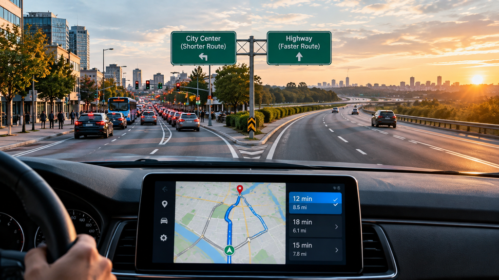
GPS can determine a device’s position, while route calculation relies on detailed digital maps. The maps include details on roads, intersections, directions, distances, speed limits, and restrictions. Navigation systems break up the road network into an interconnected set of road segments and study the various routes between the current vehicle location and the destination.
Values can be assigned to each section of the road based on distance, travel time, and other factors. The navigation system calculates routes among a large number of possible options and looks for the most suitable one. There may be thousands of routes in a large city, and high-tech route-finding software is required to deliver directions swiftly. This system can also track the trip and revise its path if significant changes occur in the circumstances.
Why the Shortest Route Is Not Always the Fastest
Distance does not always equal travel time, as can be seen by comparing travel on city streets versus highways. If one route is six miles in length and goes through a very busy city, while another route is nine miles long but goes on a highway, there can be a significant difference in how quickly each route can be traveled. The shorter route may include numerous traffic lights, intersections, buses, pedestrians, and slow-moving vehicles. The driver could end up spending a significant amount of time stopping and waiting.
The highway can allow for longer periods of steady travel. The driver may have fewer stops and fewer intersections and spend more time moving. The vehicle may travel farther, but the trip could take less time. Navigation systems then make comparisons based on estimated travel times rather than simply minimizing distance.
Speed Limits and Road Classifications
There are different kinds of roads for various types of transportation. Typically, highways and expressways have higher speed limits and uninterrupted traffic, while residential streets and local streets may have lower speed limits and more stops. Road classification and speed data are used by navigation systems to calculate the speed at which vehicles can move between various segments of a route.
However, the speed limit does not always represent how fast a driver can travel. Heavy congestion could happen on a road that has a high speed limit, while a smaller road may have smoother traffic. More realistic estimates are provided by navigation systems using information on road types and traffic conditions. This assists the system in determining whether a larger road, such as a highway, or a smaller alternative road is likely to be quicker.
How Traffic Congestion Affects Route Recommendations
One of the primary reasons why a navigation app might suggest a longer route is traffic congestion. A direct road may turn into a very slow road if there are a large number of cars and they frequently have to stop and start. A longer alternative may avoid the congested area and provide more space for traffic to move through, thus having a shorter overall travel time.
Current traffic information can be used in navigation systems to help estimate the speed of vehicles on specific roads. If traffic conditions change, there may also be a change in the estimated arrival time. If a crash or traffic jam arises ahead, the app can examine different routes and advise on an alternative one. This enables GPS navigation to deal with real-world conditions rather than just following a route that was programmed at the start of the trip.
Delays at Intersections and Traffic Lights
While intersections do not add to the route’s physical distance, they can have a significant impact on travel time. The longer a driver has to stop at many traffic lights, the longer he or she will spend traveling. This means that a shorter route with a number of intersections may be slower than a longer route with fewer intersections.
Delays experienced while turning can also become a problem, particularly at high-traffic intersections. Complicated turns can increase travel time, so navigation systems might opt for less complicated routes. If a street is very busy, sometimes a longer route around the area might achieve a better outcome than a direct route through several traffic signals and intersections.
Construction, Accidents, and Road Closures
Conditions on the road can sometimes change quickly, making one route faster than another. Construction can block lanes and slow down traffic, while accidents can cause serious traffic jams or the total closure of a road. Navigation systems with updated information can take these events into consideration while calculating routes.
An earlier quickest route could turn into a slow route once an accident happens. The navigation system can also calculate the time it will take to travel on other available roads and determine if it is worth taking an alternative route. The new route might be longer, but if it helps avoid a big delay, then it could actually be the quicker and easier option.
How Historical Traffic Patterns Predict Delays
Current traffic information is not the only criterion navigation systems rely on. Historical traffic patterns can be used to forecast the typical behavior of roads at specific times. Some roads can be busy at certain times of the day, such as during rush hour in the morning and evening, but not at other times.
For instance, a route could be recommended at 8:00 a.m. but not at midnight. Historical data can be used to estimate the traffic conditions that are likely to occur at a given time and day. These patterns can be used in conjunction with existing traffic data to make more accurate travel-time estimates.
User Preferences and Toll Roads
Another distinction between the fastest route and the best route may involve toll roads. A toll road can be used to travel faster and with fewer interruptions, but the driver must pay a toll. Some may think the time saved is worth it, while others may want to take a slower but no-cost path.
Most navigation apps offer customization options, including the ability to avoid toll roads, highways, or ferries. These settings have a great influence on the recommended route. The fastest route may not always be the most budget-friendly, and the shortest route may not always be the most convenient to drive. The user can influence which option the navigation system chooses based on personal preferences.
Why Navigation Apps Recommend Longer Routes in some cases
If a driver is presented with a longer route on the map, he or she might think that the navigation system has made an error. However, the app might be taking in data that is not readily apparent. The shorter route may be more congested, have more traffic lights, construction, accidents, or lower average speeds.
The longer route may be more likely to provide access to faster roads and smoother traffic flow with fewer delays. Navigation systems calculate the estimated travel time of each section of the road network that the route uses and then make a recommendation. That means it is possible for a longer route to be the quicker one.
Route Optimization During a Journey
Once the driver has started driving, the optimization process can still continue. Some navigation systems will track traffic and adjust the predicted arrival times along the way. In the event of significant congestion ahead, the app could analyze other routes and suggest an alternative path.
Navigation systems do not always have to reroute for each minor delay, as this could be confusing for drivers. Instead, they compare the potential savings in time with the inconvenience of changing direction. Continuous analysis enables navigation systems to adjust to road conditions and provide more meaningful directions.
Conclusion
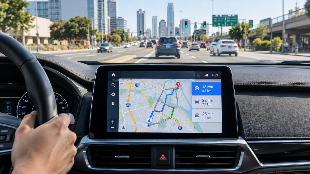
GPS navigation is far more sophisticated than simply determining a route with the shortest mileage. Modern systems can examine distance, speed limits, road types, traffic congestion, intersections, accidents, construction, tolls, historical traffic patterns, and user preferences.
Not all of the shortest routes are the fastest, and not all of the fastest routes are the optimal choice for every driver. One driver may prefer to take a faster road and bypass traffic, while another may want to avoid tolls and highways. Knowing how GPS navigation determines paths can help drivers understand why navigation programs sometimes offer a route that may seem longer but is actually a faster, smoother, and more convenient path.