Introduction
In the fast-changing landscape of autonomous vehicles, robotics, and smart infrastructure, LiDAR (Light Detection and Ranging) has become a cornerstone technology. It enables machines to perceive the world in 3D, capturing rich spatial data in real-time. Yet, LiDAR on its own has limitations: it can distinguish shapes but not reliably determine what is moving versus what is static. This is where “lidarmos” comes in—a term increasingly associated with LiDAR-based Moving Object Segmentation (LiDAR-MOS).
Across blogs, academic papers, and industry experiments, lidarmos is emerging as a buzzword that captures the fusion of LiDAR with advanced motion segmentation. The result is technology capable of distinguishing pedestrians, cyclists, vehicles, and other moving objects from background structures, all in real time.
This article explores lidarmos in detail: what it is, how it works, its benefits and challenges, research milestones, and why it’s becoming essential to the future of autonomy.
What is Lidarmos?
The word “lidarmos” has two distinct but connected meanings:
- LiDAR-MOS (LiDAR Moving Object Segmentation):
In the research and engineering world, lidarmos is shorthand for LiDAR-MOS, where deep learning and temporal data analysis are used to segment dynamic elements from static environments in 3D point clouds. This improves navigation, mapping, and safety. - Lidarmos.net and related blogs:
Recently, “lidarmos” has also been used as the name of a digital media platform focusing on AI, robotics, and LiDAR-related discussions. While useful for mainstream readers, this usage is more brand-oriented. For our purposes, the technological meaning—LiDAR-MOS—will be the core.
How Lidarmos Works
LiDAR Data Collection
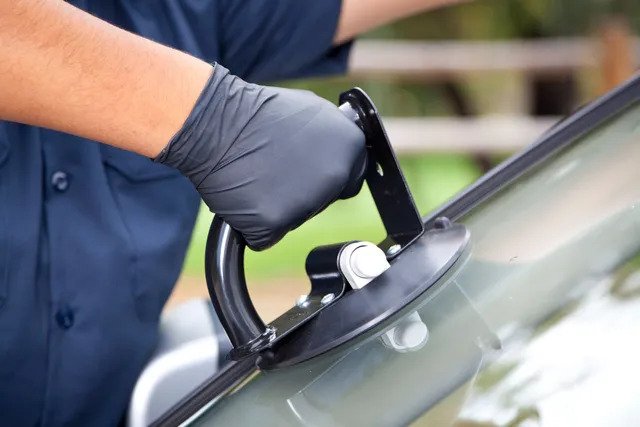
A LiDAR sensor emits laser pulses and measures how long they take to return, creating a 3D “point cloud” of the environment. Each scan provides millions of data points representing distances and surfaces.
Temporal Analysis and Residual Images
The real innovation in lidarmos lies in using sequential LiDAR scans. By comparing frames over time, algorithms can construct residual images that highlight differences between scans. These differences are often moving objects—cars, bikes, people—that need to be tracked.
Deep Learning Models
Modern lidarmos systems use convolutional neural networks (CNNs) and temporal architectures to classify points as “moving” or “static.”
- LMNet (LiDAR-MOS Network): An early open-source model that set benchmarks.
- MambaMOS (2024): Uses motion-aware state space modeling for higher accuracy.
- HeLiMOS dataset (2024): Provides training material across multiple LiDAR sensor types, solving data scarcity.
Outputs: Clean Maps and Safer Navigation
By filtering out moving objects, lidarmos helps create cleaner maps for SLAM (Simultaneous Localization and Mapping) and ensures autonomous systems can distinguish between permanent obstacles and temporary hazards.
Why Lidarmos Matters
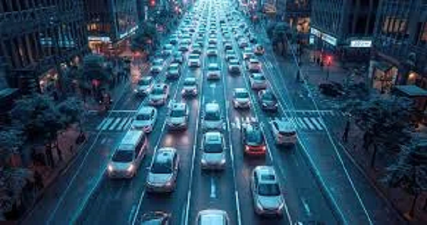
Safer Autonomous Vehicles
For self-driving cars, distinguishing a parked vehicle from one about to pull into traffic is critical. Lidarmos enables AVs to handle such nuances with greater reliability.
Smarter Robotics
Delivery robots, warehouse automation, and drones all require precise navigation. Lidarmos empowers these machines to adapt to dynamic human environments.
Environmental Monitoring
In urban planning and smart cities, lidars can separate vehicles and pedestrians from static infrastructure, making real-time monitoring more meaningful.
SLAM Improvement
SLAM systems rely on stable environmental references. Moving objects cause “ghosting” in maps. Lidarmos cleans these maps, enabling long-term accuracy.
Challenges Facing Lidarmos
- Weather Conditions:
Rain, fog, and snow can degrade LiDAR signals, leading to misclassification. - Computational Load:
Real-time motion segmentation requires significant processing power, which raises cost and energy consumption concerns. - Large Data Volumes:
Continuous LiDAR scans generate vast amounts of data. Storing and processing this data efficiently remains a bottleneck. - Generalization Across Sensors:
Different LiDAR sensors vary in resolution and field of view. Training models that generalize well is still a research challenge. - Labeling Training Data:
Creating annotated datasets for moving/static segmentation is time-intensive. Automatic labeling techniques, like those introduced in HeLiMOS, are helping.
Research and Development Milestones
- 2021: LiDAR-MOS (LMNet)
Introduced by PRBonn, LMNet became the first large-scale open-source model for moving object segmentation, tested on the SemanticKITTI dataset. - 2024: MambaMOS
A motion-aware state space model presented at ACM MM 2024. It improved temporal modeling, providing better accuracy in dynamic environments. - 2024: HeLiMOS Dataset
Introduced at IROS 2024, this dataset addressed the problem of heterogeneous LiDARs, supporting more robust training across devices.
Together, these efforts have cemented lidarmos as a credible and growing research field.
What Blogs and Media Are Saying
Over the last year, a wave of blogs has pushed “lidarmos” into the public domain:
- TheMotoStreet: Emphasizes temporal scanning and range/residual images as the basis of lidarmos.
- BlogWires: Frames lidarmos as real-time mapping for AI integration, with use cases in AVs and smart cities.
- HelloGreeting: Discusses lidarmos alongside related research like MambaMOS and HeLiMOS.
- MegaMagazine: Highlights safety and the importance of moving object segmentation for AV adoption.
- TrendLoop360: Positions lidarmos as a breakthrough, stressing challenges and opportunities in multi-sensor fusion.
This wave of content indicates that lidarmos is not only a technical trend but also a keyword entering mainstream tech awareness.
Practical Applications
Autonomous Vehicles
- Detecting jaywalking pedestrians.
- Differentiating parked vs moving vehicles.
- Handling complex urban intersections.
Drones
- Avoid moving obstacles like birds or other drones.
- Monitoring traffic flows from above.
Smart Cities
- Improving real-time pedestrian and vehicle monitoring.
- Enabling adaptive traffic lights.
Security & Defense
- Tracking moving objects in surveillance scenarios.
- Identifying unusual motion patterns.
The Future of Lidarmos
Looking forward, Lidarmos is poised to integrate with other technologies:
- Sensor Fusion: Combining LiDAR with radar, camera vision, and thermal imaging.
- Edge Processing: Running lidarmos models directly on embedded chips to reduce latency.
- Standardization: As datasets like HeLiMOS grow, standard benchmarks will emerge.
- Commercialization: Expect lidarmos to appear as a feature in AV stacks, drones, and robotics platforms within the next 3–5 years.
The term “lidarmos” may have started as a niche research reference, but it is evolving into a keyword for next-generation autonomy.
Conclusion
Lidarmos represents a crucial shift in the perception and intelligence of machines. By marrying LiDAR’s 3D spatial awareness with motion segmentation, it delivers cleaner maps, safer navigation, and smarter decision-making. From autonomous vehicles to drones and smart cities, the applications are broad, and the impact is profound. As both researchers and bloggers amplify the term, lidarmos is poised to become a defining keyword of the 2020s in the realms of autonomy and AI. And if you’re looking for more explorations of future technologies, make sure to check out my blog, BaddiehubX, where we dive into trends shaping the world of tomorrow.