Introduction
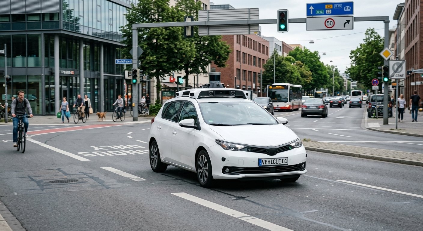
Autonomous vehicles have revolutionised the transport industry by allowing vehicles to autonomously drive using intelligent systems. This includes seeing obstacles, understanding traffic conditions and driving with little or no human interaction. The vehicles work by using a mixture of cameras, LiDAR, radar, AI and advanced computing to understand the physical world. A lot of this is enabled by the use of computational geometry.
Computational geometry is a field of computer science and mathematics that allows for efficient analysis of spatial relationships, distance calculations, shape recognition and solving of geometric problems. This enables autonomous vehicles to understand where objects are, see the edge of the roads, estimate motion and understand safe routes. This is an important area of autonomous vehicles and helps to understand the raw sensor data.
Computational Geometry in Autonomous Vehicles
Computational geometry is the use of algorithms and mathematics to solve geometric problems. Problems include points, lines, curves, polygons, surfaces, distances, intersections. Autonomous vehicles use this to understand the physical world. Autonomous vehicles have constant data coming from the road, buildings, people, vehicles, traffic signs and obstacles. However, they still need to process this data by calculating spatial relationships and organising the data. Computational geometry provides the mathematics to do this efficiently. For example, geometric algorithms can calculate how far away another vehicle is, whether an object is within the driving area and the edge of the available road.
Computational geometry is very important in autonomous vehicles due to the way sensors provide data from various sources. For example, cameras provide visual data, LiDAR provides distance measurements using lasers and radar provides objects and motion. Using geometric calculations can help to understand how the objects are positioned and what relationships there are between the objects. This can help the vehicle to better understand the environment. It helps the autonomous vehicles with mapping, object detection, localisation, path planning and collision prediction.
How Computational Geometry Help LiDAR Point Clouds
LiDAR Technology
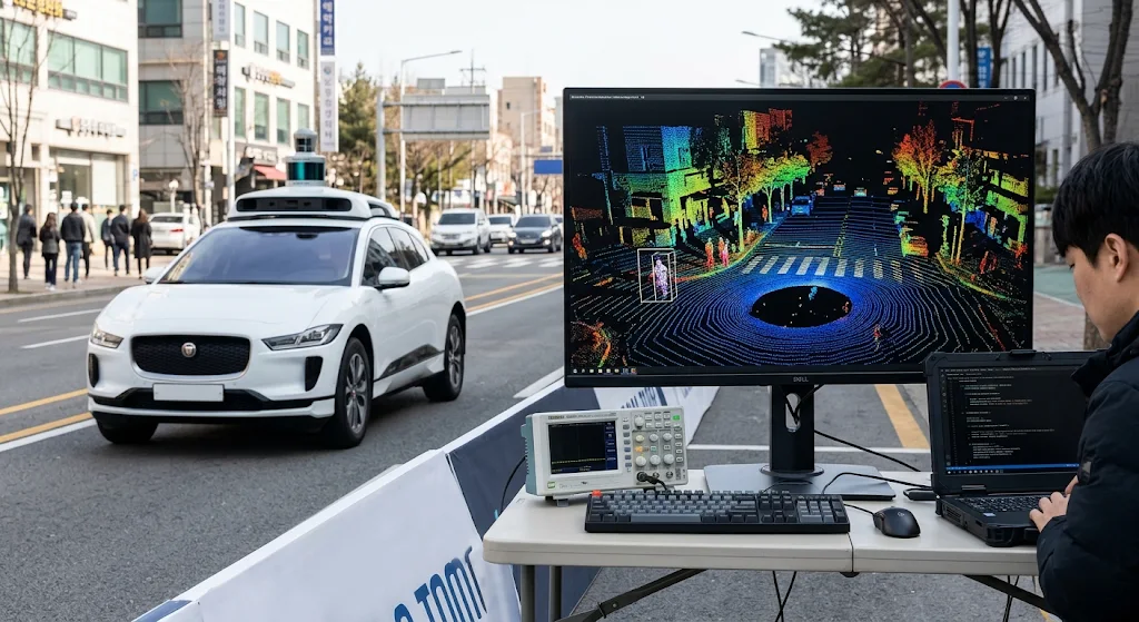
LiDAR (Light Detection and Ranging) is one of the most important sensor technologies used in autonomous vehicles. The technology uses lasers and calculates how long it takes for them to come back after hitting an object in the environment. This can then be used to calculate distances and create detailed 3D maps. This provides the vehicle with a ‘point cloud’ of data.
This refers to a collection of data points showing where something is in 3D space. LiDAR can provide millions of data points showing where roads, buildings, trees, vehicles, people and other objects are. This can be used in autonomous vehicles, however Computational geometry can help organise the data, find patterns, calculate distances and pick out important elements.
Point Cloud Processing Using Geometry
LiDAR Point Clouds can be processed using various geometric algorithms. This includes clustering, surface detection, segmenting and measuring. Clustering algorithms can help group together points that are near each other, as this means they are likely to be part of the same object. This helps the vehicle to see individual cars, people, objects on the side of the road and other obstacles.
Surface detection can help to find flat or continuous areas. This can help the vehicle to see where the road is. Geometry can help to calculate the size, orientation and location of objects. For example, if there is a cluster of points forming a rectangle it could be another vehicle. If there is a cluster of fairly flat points this could be part of the road. This will help autonomous vehicles to process massive amounts of data.
Road Edge Detection
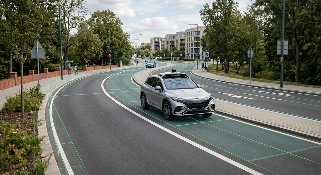
It is important to know where the edge of the road is to keep the autonomous vehicle in a safe driving area. The vehicle must know where the lane markings, edge of the road, pavement, traffic islands and other objects are. Cameras can give information on visible lane markings, whilst LiDAR can give 3D data on the road.
Computational geometry can help understand the data. Lines, curves and surfaces can be identified. Algorithms can find where the points are and calculate the direction of the road markings. This is important on roads with bends, rough surfaces, faded lane markings and complex junctions.
Curve Detection
Sometimes roads aren’t straight and clearly marked. In urban areas the autonomous vehicle might encounter roundabouts, merging lanes, sharp bends and complex junctions. Computational geometry can help by allowing the vehicle to represent the road edges mathematically.
Spline fitting and Polynomial Curve Estimation can help to estimate the shape of the road. This helps the vehicle to work out how much the road is changing direction. Calculations can also be done to find the relationship between the current position and lane edges nearby. This means the autonomous driving system can adjust the steering and positioning of the vehicle.
Object Detection and Positioning
Object Detection
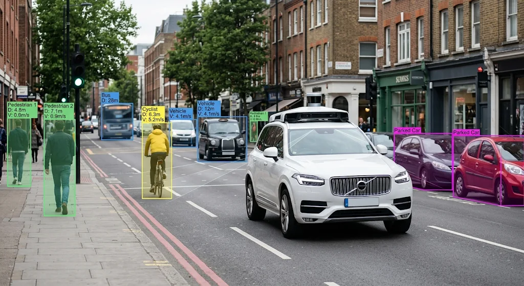
Autonomous vehicles must recognise different objects and understand where they are in relation to the vehicle. This can include people, cyclists, motorbikes, parked cars, moving vehicles, traffic barriers, traffic signs and unexpected obstacles. Cameras and AI models can help recognise the visual features of objects.
LiDAR and radar can also provide information. Computational geometry can help by calculating the size, distance, orientation and boundary of objects. For example, if a pedestrian has been detected, geometry can help calculate where they are in relation to the vehicle. This enables the autonomous system to understand if the person is near the road.
Distance Calculation
Knowing where an object is isn’t enough to make safe decisions. The vehicle must know where the object is, how far away it is and if it may cause an obstruction. Computational geometry can help calculate distances between objects, sizes of objects and where they are in a 3D coordinate system. Bounding boxes are often used to show the boundary of objects.
Transformations can be done to put the sensor data into a consistent reference. This is especially important if there are multiple objects detected. The vehicle may need to track multiple people, cars nearby and obstacles on the side of the road. Knowing where objects are in space can help the driving system to understand the relationships.
Path Planning
Path planning involves finding a suitable route for the autonomous vehicle to travel from one point to another. The vehicle needs to understand the environment, know where it can drive and calculate possible movement. Computational geometry can help by representing the road, obstacles, boundaries and areas that can be driven in.
Algorithms can help to analyse possible routes, calculate distances, identify intersections and see if the proposed route is too close to surrounding objects. This helps autonomous vehicles to drive around complex environments such as busy roads, car parks, highways and junctions. The autonomous system can continuously update the movement plan.
Finding Safe Routes
One of the biggest challenges in autonomous navigation is finding a safe route when there are obstacles in the driving area. Computational geometry can help by representing the obstacles in space so the vehicle can avoid them. For example, if an autonomous car is approaching a parked car, it can calculate alternative routes around it.
Algorithms can analyse the available space to find possible routes. They can also check if a proposed movement is safe geometrically. Techniques such as Voronoi diagrams, configuration spaces and visibility graphs can help with various path planning problems. This can be combined with traffic rules, speed limits and other road users to decide a suitable route.
Collision Prediction
Computational geometry can help with collision prediction. The autonomous vehicle must continuously decide if it is going to hit another vehicle, person, cyclist or parked object. This needs to take into consideration where objects are, their size, direction and estimated movement.
Computational geometry can help by calculating distances between objects, identifying boundaries and intersections. For example, if another vehicle is approaching an intersection the autonomous system can calculate where they are likely to go. If this is likely to overlap with the planned route at a similar time then the system will know there is an issue.
Safe Distance Calculations
Geometry can also help autonomous vehicles to keep appropriate distances from other road users. The system can calculate how much space is required for turning, lane changes, stopping and avoiding obstacles. This can become more complex if the objects are moving.
By combining geometry with movement estimations the vehicle can work out how the relationships might change over time. For example, if the car in front suddenly slows down the autonomous vehicle needs to work out how much stopping distance is available. Computational geometry can provide the spatial data and predictive models can help estimate where objects will be.
Computational Geometry with AI and Machine Learning
Computational geometry can provide vital maths to help understand spatial relationships however autonomous vehicles also use AI and machine learning. AI can help analyse the large amount of sensor data. It can help identify patterns, classify objects and make decisions based on changing road conditions. Machine learning models are often trained using large sets of data including images, point clouds and sensor data.
This can help identify people, vehicles, traffic signs, lane markings and other important objects. Computational geometry can help by providing accurate measurements of where objects are, how far away they are, how they look and what relationships there are. For example, an AI model might know that an object is a person, however geometry can tell how far away they are and if they are in the projected path.
Computer Vision
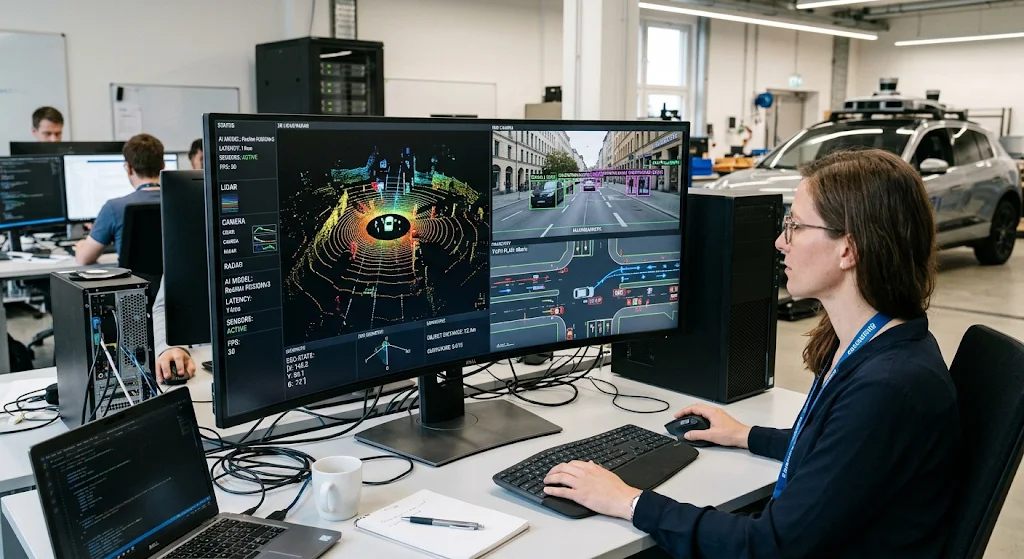
Computer vision can help autonomous vehicles understand the visual data from cameras. This can help with image classification, object detection, lane detection, identifying traffic signs and understanding the road. However, camera data can be problematic as it is 2D and doesn’t provide accurate distance measurements.
Computational geometry can help by using techniques such as camera calibration, perspective and 3D reconstruction. This helps the system understand where objects are in relation to the image. Combining this with machine learning can help identify important objects. Geometry can also provide extra information on where objects are and their size. This helps the vehicle understand the road.
Sensor Fusion
Sensor fusion involves using a combination of sensors to get a better understanding of the environment. Autonomous vehicles often use a combination of cameras, LiDAR, radar and other positioning technologies. Each has their own strengths and issues. Cameras provide detailed data but can struggle in poor lighting. LiDAR provides accurate distance measurements and 3D data.
Radar can provide useful information on the movement of surrounding objects. Computational geometry can help by putting all the data into a consistent coordinate system. For example, the vehicle might use camera data to recognise another car and LiDAR data to calculate how far away and big it is. By combining the two we can have a more reliable representation.
Challenges with Computational Geometry
There are various challenges with using computational geometry in autonomous vehicles. Firstly, autonomous vehicles can generate vast amounts of spatial data. Modern LiDAR systems can generate millions of points. Cameras and radar will constantly provide more data. The autonomous driving computer must be able to process this quickly to make decisions.
If it takes too long to process this information the system may not react quickly enough to the changing road. Computational geometry algorithms must strike a balance between accuracy and speed. This can be achieved using efficient data structures, spatial indexing, parallel processing and optimised algorithms.
Sensor Issues
Sensors aren’t always perfect. Rain, fog, dust, bright light, reflective surfaces and obstacles can all cause issues. LiDAR point clouds can be noisy and cameras can become difficult to understand in poor visibility. Some objects may also be partially obscured by other vehicles or objects on the side of the road. This can cause issues with the reliability of the geometry calculations.
To overcome this autonomous driving systems use filtering, statistical estimation, sensor fusion and uncertainty. Computational geometry can help organise the data however the system must understand when there is incomplete data. This is important as the vehicle should make decisions taking into consideration possible errors.
Efficient Processing
There are also issues with getting the geometry algorithms to run efficiently on the hardware. Unlike large data centres, the vehicle doesn’t have much space so the computer can’t use much power or produce too much heat. The computer must perform several intensive tasks such as image processing, object detection, localisation, mapping and path planning.
The algorithms must be efficient and not perform any unnecessary calculations. This can be achieved using spatial partitioning, hierarchical data structures, approximate nearest neighbour and parallel computing. Accelerators such as graphics processing units can also help with intensive mathematical and AI tasks. Finding the right balance between speed, efficiency and accuracy is important when creating reliable self-driving vehicles.
Applications in the Real World
Computational geometry can be used in many different situations. On highways it can help the vehicle understand where the lane is, keep safe distances from other cars, understand the edges of the road and analyse possible lane changes. In urban areas it can help the vehicle navigate busy roads. Autonomous parking systems also use geometry to understand how much parking space there is, how far away other vehicles are and what manoeuvre would be best.
In industrial environments autonomous vehicles can use the same techniques to navigate warehouses and transport materials. This shows that computational geometry can be used in many different situations. It provides a common mathematical basis to understand spatial relationships.
Future of Computational Geometry
Computational geometry is likely to remain an important part of Autonomous Vehicles
As technology develops. With improvements to LiDAR, cameras, onboard computers and AI there are many opportunities for more detailed and accurate spatial analysis. Future autonomous vehicles may use more complex geometry algorithms to understand complex environments, identify unusual obstacles and predict interactions between multiple road users. Improvements to 3D mapping and real-time sensor fusion can help vehicles understand unfamiliar roads. However, care must be taken to ensure the data is processed efficiently, sensors are reliable, data is good quality and the system validated. We want the vehicles to be able to perform more calculations however we want them to make reliable decisions.
High Definition Mapping
High definition mapping is becoming more popular. This provides detailed information on roads, lane boundaries, junctions, traffic infrastructure and other geographical information. Computational geometry can help create and maintain this. This can be done by analysing spatial data and identifying relationships between objects.
The autonomous vehicle can compare this to the sensor data to improve localisation. As mapping becomes more detailed and updated regularly geometry algorithms will play an important role. This can be combined with AI based perception and predictive models to create more advanced autonomous vehicles.
Conclusion
Computational geometry is a fundamental technology that helps develop autonomous vehicles. It provides mathematical methods to understand spatial data, process LiDAR point clouds, identify road edges, detect obstacles, calculate object positions, plan driving paths and predict possible collisions. Computational geometry becomes even more valuable when combined with AI, machine learning, computer vision and sensor fusion.
This allows autonomous vehicles to turn raw sensor data into meaningful information. Despite having issues with large data, sensor issues, processing delays and hardware, improvements are being made to geometry algorithms and computers. This means there are many opportunities for autonomous transport. As autonomous vehicles become more advanced, computational geometry will remain an essential part of helping vehicles understand their environment, navigate and make informed decisions.